We’ve partnered with the US National Archives and Records Administration (NARA) to help make up to 100,000 newly digitized photographs and several hundred reels of film from the WWI-era available for reuse, and have made a large number of these sources available through a Remembering WWI tablet app aimed in large part at educators and local institutions.

- As a data enrichment for spatial history/mapping courses
- For students looking to work with cultural heritage/archival data
- Opportunities to work with JSON archival data on Github
- Reusing this data for a research/data visualization project
Project idea: enriching WWI photographs with geospatial data
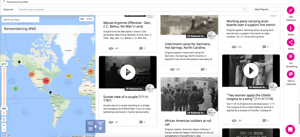
- As Historypin is a mapping platform, a key piece of data missing from the photographs in NARA’s Catalog are latitude-longitudes.
- Much of this needed information is found in the title and description information of each photo, and is thus a great data enrichment opportunity.If we can enrich the location data for some of these items, the dream is to be able to map thousands of items on Historypin. Here is what we’ve mapped so far.
Why help?
The more NARA photographs we can map on Historypin, the more teachers and local institutions will be able to reuse these expertly-digitized primary sources with their students and in their programming. Any items mapped on Historypin are fed directly into the companion Remembering WWI tablet app via Historypin’s API.
Most of the work so far has been manual, so this is great potential project for students or others who can help prepare larger swaths of the data available for mapping on our site.
You can find and export the data we’ve started to enrich here.
Exporting NARA JSON data directly from the Catalog
The full range of 100,000 photographs are also available for a JSON export in the National Archives’ Catalog. While enriching location data is a sample project we have in mind for students, the data is there for you to reuse as you’d like.

This project is made possible in part by an anonymous donor and the National Archives Foundation.